When buying a house, you’ll want to know how future earthquakes might affect you, and which of the natural hazard disclosures to read closely. This is part two of a three-part series looking at what to consider when buying a house in earthquake country.
When there’s a house you’re serious about, you’ll receive a substantial disclosure packet. In part one of this series, we looked at the earthquake fault zone disclosure. Here, we’ll explore the seismic hazard zone disclosure, which examines the risk of soil liquefaction and landslides for a property.
Disclosure: Seismic Hazard Zone
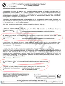
Among the 300+ pages of disclosures, find the natural hazard disclosure statement. Part one of our series shows a larger example of what it looks like. On this page of disclosures, check to see if the property is in a seismic hazard zone.
The seismic hazard zone refers to areas of soil liquefaction and landslide, which can cause disturbing destruction. Even without a disclosure statement, you can find out if you’re in a soil liquefaction or landslide zone on the interactive California Geological Survey map. See further detailed reports at the California Geological Survey Information Warehouse.
What is Soil Liquefaction?
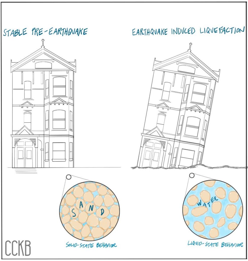
Soil liquefaction, also called earthquake liquefaction, occurs in areas with soft, saturated soils. When you zoom-in on liquefiable soil, you see sand and water. The strength of the ground depends on the interlock of the sands and the quantity of sand versus water. During an earthquake, the shaking shifts the sand and loosens-up the grains so that there’s no more interlock. This creates void space that fills with water. Now, with water flowing between the sand grains, the soil behaves like a liquid instead of a solid.
You can create your own liquefaction the next time you visit a beach. Jiggle your foot up and down on the surface of the wet sand until the interlock in the sand gives way. It will start rippling like a liquid.
During soil liquefaction, buildings may tilt and sink into the ground, utilities underground may come to the surface, and roadways might crack.
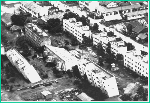
Soil liquefaction typically occurs in coastal areas or areas near bodies of water. A USGS estimate reports that 25 percent of the SF Bay Area is susceptible to soil liquefaction. The Los Angeles Area is also a high liquefaction zone.
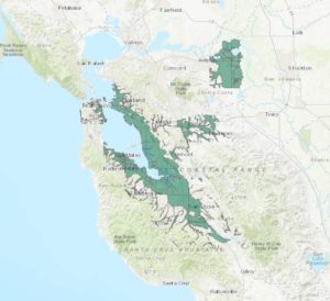
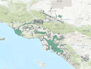
For a building to remain standing in liquefiable soils, it must have a robust foundation to withstand the higher force than if it were on non-liquefiable soils. The majority of structures have not been built to withstand the additional force from liquefied soil. Many structures on liquefiable soils were built before those locations were a known hazard. Today, before building a structure in a soil liquefaction zone, a soil investigation is required.
USGS and CGS provide some recommendations to mitigate the risk of soil liquefaction:
(1) avoiding hazardous areas, (2) purchasing insurance to cover anticipated losses, (3) “improving” the ground so it is less susceptible to liquefaction or so that if liquefaction does occur the amount of surface deformation is reduced, and (4) fortifying structures to withstand liquefaction of underlying soils.
For the purpose of home-buying, it’s most realistic either to avoid hazardous areas or buy insurance (items 1 or 2). Conducting ground improvements or sufficiently strengthening the structure (items 3 and 4) are typically only cost-effective for large buildings.
Landslides Causes by Earthquakes
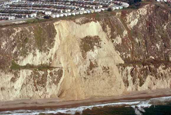
Another type of soil failure is a landslide, which occurs in sloped areas, due to erosion, snow, rainfall, or earthquake shaking. Occasionally, landslides can also be caused simply by building structures on a hill that cannot withstand any extra weight.
During fast-moving landslides, rocks, soil and fluids can travel at speeds approaching several tens of meters per second. Fast-moving landslides are often destructive and catastrophic events. However, not all landscapes are sudden catastrophic events. Slow-moving landslides can start and stop for decades and not advance more than 1 meter per year. Many of these landslides are called earthflows. Slow-moving landslides are very common and can cause damage to infrastructure. Occasionally, slow-moving landslides can fail catastrophically and quickly transition into fast-moving landslides resulting in large amounts of damage or casualties.
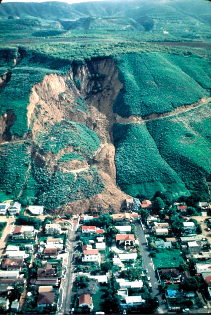
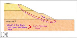
If you did an experiment and poured soil on the ground, it would come to rest at a specific slope, called the angle of friction. The soil is stable at that angle, as long as it’s undisturbed, but with ground shaking or other added loads, the soil isn’t strong enough to maintain its angle of friction. The soil slips, causing landslides.
The image below shows a cross-section of a hillside. The red line indicates the failure surface. The weight of the soil plus the additional force from an earthquake will exceed the friction force, and the block of soil above the red line will slip downward, exposing the failure surface. That is how a landslide occurs.
According to a USGS study on earthquake-induced landslides, by David Keefer, landslides mainly occur in earthquakes ranging from Magnitude 6.0 to 8.0, with the landslide area ranging from 100 square miles to 38,000 square miles. While there are 14 different types of landslides, the most dangerous ones are rock avalanches (E), rapid soil flows (H), and rock falls (D).
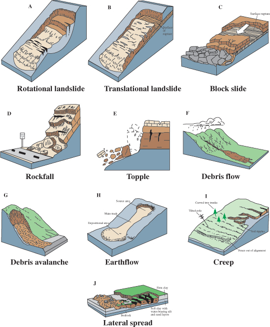
Seattle is a high-population area that’s susceptible to earthquake-induced landslides. A study by Seismology Society of America shows that landslides could impact 8,000 buildings in Seattle if the grounds are saturated.
Combined Seismic Hazards
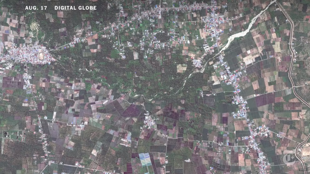
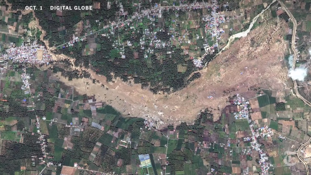
When both soil liquefaction and landslides occur in combination, the effects are particularly devastating. This occurred in 2018 in a magnitude 7.5 earthquake in Palu, Indonesia, when soil liquefaction triggered rapid soil flows. The satellite photos show before and after the earthquake, and the extent of the damage. Refer to The New York Times footage to see other impacted surrounding areas. The earthquake caused 2,100 deaths, displacement of 78,994 people, and damage to 68,451 houses.
Next: Part 3, Areas of Potential Flooding
Seismic hazard zones and distance from fault zones are two indicators for potential earthquake damage to a property. In part three of this series, we’ll explore the Areas of Potential Flooding disclosure when buying a house in earthquake country.
—
This article is educational and informational in nature. It is not intended as legal, expert or other professional advice, or as any form of recommended minimum standard or best practice. Users, we advise you to carefully review the ideas and information presented herein with qualified professional advisors prior to acting upon or implementing said ideas and information.
Reviewed by Victoria Chames. Original publish date March 19, 2019.

