Finding a house to buy is whirlwind of emotions. It’s important understand how future earthquakes might affect you, and which of the natural hazard disclosures to read closely. This is part one of a three-part series looking at the importance of location, location, location when buying a house in earthquake country.
Natural Hazard Disclosures
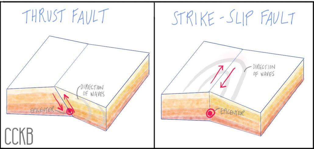
When you are in the market for a house, find the natural hazard disclosure statement in the disclosure packet. In addition to disclosing a property’s proximity to flood and fire risk, there are three earthquake-specific disclosures:
- proximity to an Earthquake Fault Zone
- disclosure of a Seismic Hazard Zone (landslides and liquefaction)
- Area of Potential Flooding from dam failure
What is a Fault?
A fault is a fracture between two blocks of rock in the planet’s surface, along which movement and displacement occurs. When the movement occurs slowly over time, it is know as creep. When the movement occurs rapidly, it is an earthquake. Faults that are creeping are less likely to experience a large earthquake. A fault zone describes an area where there are several closely spaced faults.
The San Andreas fault line, running nearly the entire length of California, is one of the most famous fault lines in the world. The fault line lies at the boundary between two large continental plates, the North American plate in the east and the Pacific plate in the west. Meanwhile the Cascadia Subduction Zone, running along the coast of the Pacific Northwest from Cape Mendocino, California to Vancouver Island, Canada, is another dangerous fault line on the West Coast. Subduction zone faults occur where two plates are colliding against each other, causing one plate to descend beneath the other. Subduction zone faults cause the highest magnitude earthquakes, known as “megathrust” earthquakes.
In total, the state of California alone has around 15,000 fault lines, ranging in sizes. USGS offers an interactive tool to explore fault lines on the West Coast.
Disclosure: Earthquake Fault Zone
After the 1971 Magnitude 6.6 San Fernando earthquake, California passed the Alquist-Priolo Earthquake Faulting Zoning Act, which requires that buyers be informed if the home is in a fault zone.
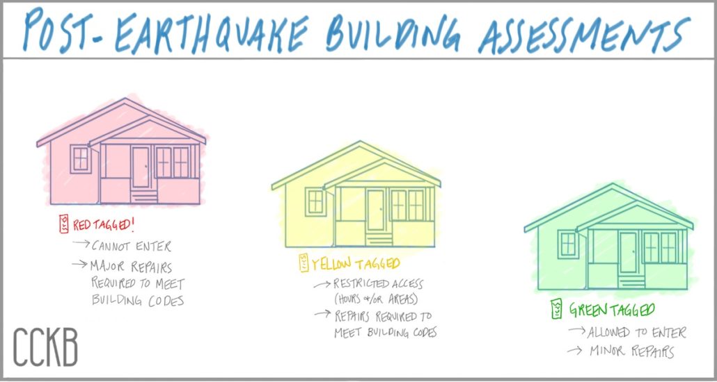
In the San Fernando earthquake, damage to houses in the fault zone was significantly higher. Roughly 30% of homes were red-tagged in the fault zone versus 5% outside of the fault zone. A red-tagged building is not safe to enter and requires major repairs to bring the house to code. Yellow tags indicate restricted access with repairs required, while green tags mean safe to enter.
The earthquake fault zone, defined by the California Geological Survey (CGS), is approximately a quarter of a mile width area along the known fault lines. CGS provides a map of California’s faults with the Alquist-Priolo zone.
Earthquake Fault Types
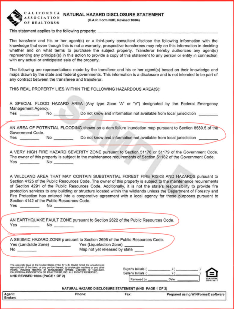
The most common fault type in California is the strike-slip fault type (like the San Andreas fault and the Hayward fault), followed by the thrust fault type (Cascadia fault).
In a thrust type fault, the earth on one side of the fault slips upward on top of the adjacent side of the fault. This sends a vertical force into the surrounding areas. It also creates horizontal shaking forces. While shaking is generally most intense at the fault line, the force travels perpendicular to the fault line. Also, shaking intensity is higher on the side that slides upward than the downward-sliding side.
For a strike-slip fault, the two sides of the fault slide past each other, moving parallel to the fault line. The waves catapult away from the epicenter along the fault line. Once again, the most severe ground shaking concentrates in the area closest to the fault line and becomes less intense moving away from the epicenter. This USGS animation of the Hayward fault scenario earthquake shows how the most vigorous shaking is parallel to the direction of the earthquake slip.
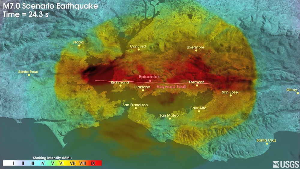
Note that the red zone is a much wider area than a quarter of a mile. Earthquake damage is not limited to the fault zone, therefore the potential for strong shaking is a much wider zone.
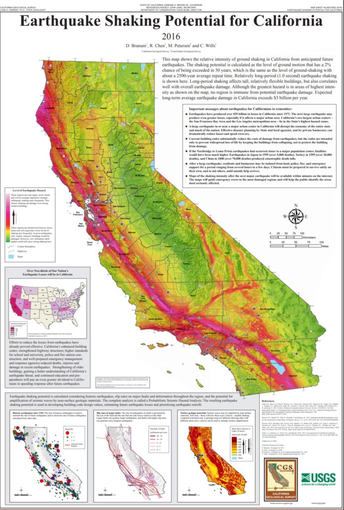
Check out USGS’s other earthquake scenarios and shake maps from previous earthquakes to see the likely shaking intensity at your house or apartment.
Temblor is also a useful tool for analyzing your likely shaking intensity.
Part 2: Seismic Hazard Zones
Distance from the fault zone is not the only indicator for potential earthquake damage. In part two of this series, we’ll explore liquefaction zones and landslide zones, also known as Seismic Hazard Zones.
—
This article is educational and informational in nature, and not intended as legal, expert or other professional advice, or as any form of recommended minimum standard or best practice. Users are advised to carefully review the ideas and information presented herein with qualified professional advisors prior to acting upon or implementing said ideas and information.
Reviewed by Victoria Chames. Original publish date November 5, 2019.

